4.42 acres in Yavapai County, Arizona


Features
- Camping
- Off-roading
- RVing
Details
4.42 acres in Yavapai County, Arizona
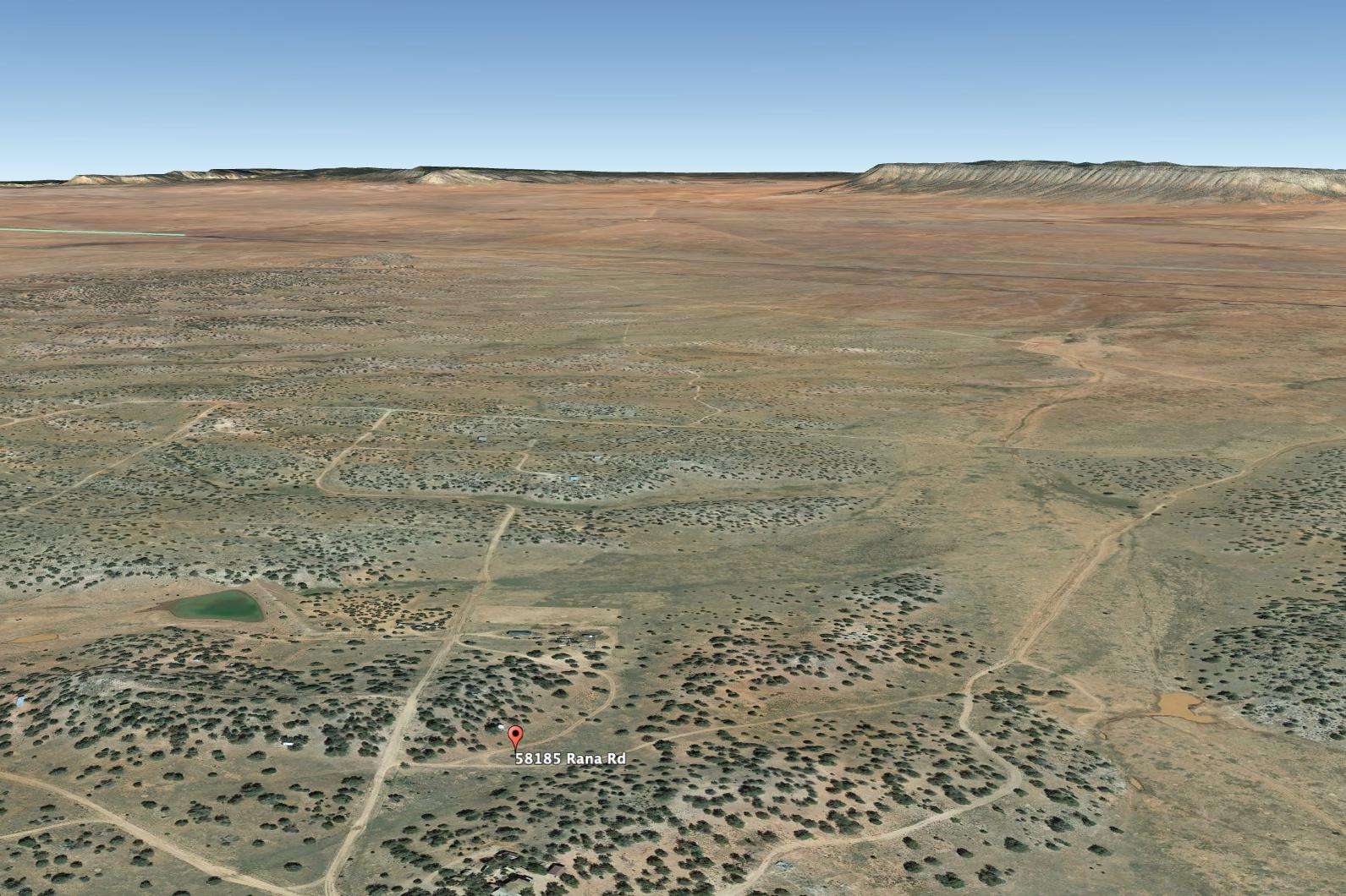
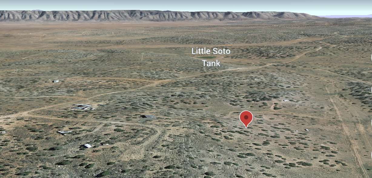
Located at popular Bridge Canyon Country Estates north of Route 40 and close to historic Route 66- This property has great views of mountains, open land and skies. This is prime desert land with diversity all around. To the north is Grand Canyon and to the South is Prescott, known for its art shows and festivities.
Our pricing is ready to sell with a great location.
The property here is perfect for a getaway home or recreation in your own private setting with juniper trees and stunning mountains for company. No too far, one may see a few houses and mobile homes. There are plenty of things to do such as hunting, fishing, hiking, biking, photography and day-trips to the hottest spots in America- such as the Grand Canyon, Lake Mead, Flagstaff and more.
This is true American desert land with diverse beauty and weather that’s just rare. Easy to build your dream stay here.
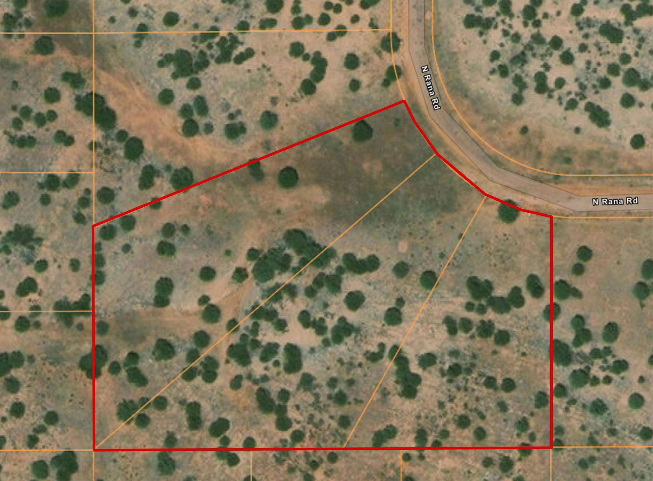
NOTE: This property can be bought as individual parcels as well with the following pricing starting from lot to the top (see parcel image):
Parcel number: 301-48-328 is 1.32 acre
price: $4495
Parcel number: 301-48-329 is 1.59 acre
price: $4590
Parcel number: 301-48-330 is 1.51 acre
price: $4550
Brief directions from Prescott,AZ (to the south):
Follow AZ-89-N and I-40W to Fort Rock Rd
Continue on Fort Rock Rd.
Take Via De Oro Pkwy and Va De Oro to Yarmo Rd
From Kingman, AZ (WEST):
Get on I-40 E/US-93 S: 7 min (3.8 mi)
Head south on N 4th St toward E Andy Devine Ave/W Historic Rte 66: 292 ft
Turn left at the 1st cross street onto E Andy Devine Ave/W Historic Rte 66: 3.3 mi
Use the right lane to merge onto I-40 E/US-93 S via the ramp to Flagstaff/Phoenix: 0.5 mi
Follow I-40 E to N Anvil Rock Rd in Yavapai County. Take exit 109 from I-40 E: 50 min (55.6 mi)
Merge onto I-40 E/US-93 S
(Continue to follow I-40 E): 55.3 mi
Take exit 109 for Anvil Rock Rd
Take Fort Rock Rd, Via De Oro Pkwy and Va De Oro to Yarmo Rd: 35 min (12.7 mi)
Turn right onto N Anvil Rock Rd: 410 ft
Turn left onto Fort Rock Rd: 4.0 mi
Turn left onto Via De Oro Pkwy: 1.2 mi
Continue straight onto Va De Oro: 0.3 mi
Continue onto Via De Oro Pkwy: 0.4 mi
Continue onto Va De Oro: 0.9 mi
Turn right onto Corona Cir/Va De Oro
Continue to follow Va De Oro: 0.7 mi
Continue onto Valley Pkwy: 0.2 mi
Continue straight onto Va De Oro: 2.0 mi
Turn right onto El Parque: 0.7 mi
Slight right onto Mesa Pkwy: 0.4 mi
Continue onto Havasu Ln: 0.1 mi
Continue onto Havasu Corners/Mesa Pkwy
Continue to follow Mesa Pkwy: 0.3 mi
Turn left onto Havasu Corners/Lader Ln: 0.5 mi
Turn left onto Shadow Mountain Pkwy: 0.2 mi
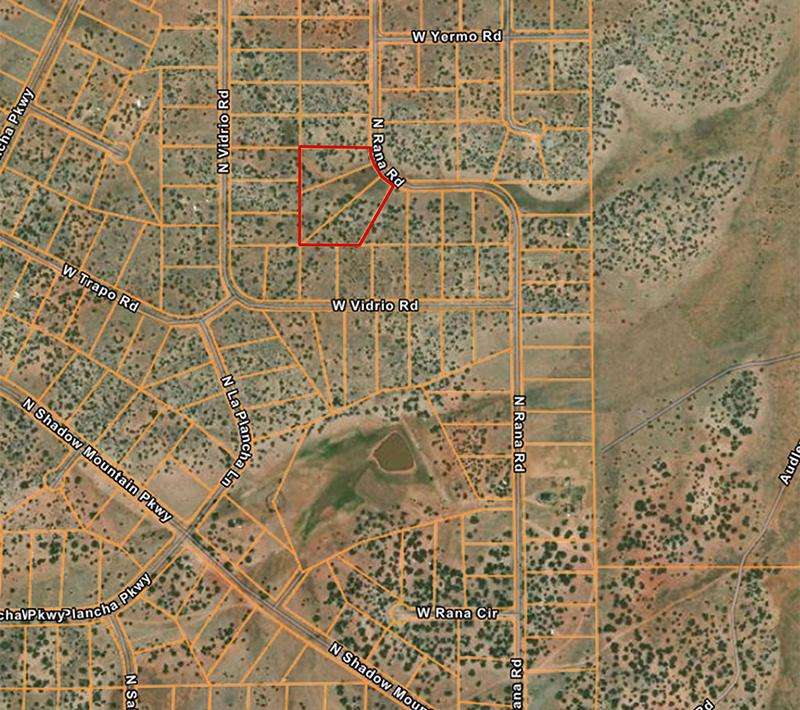
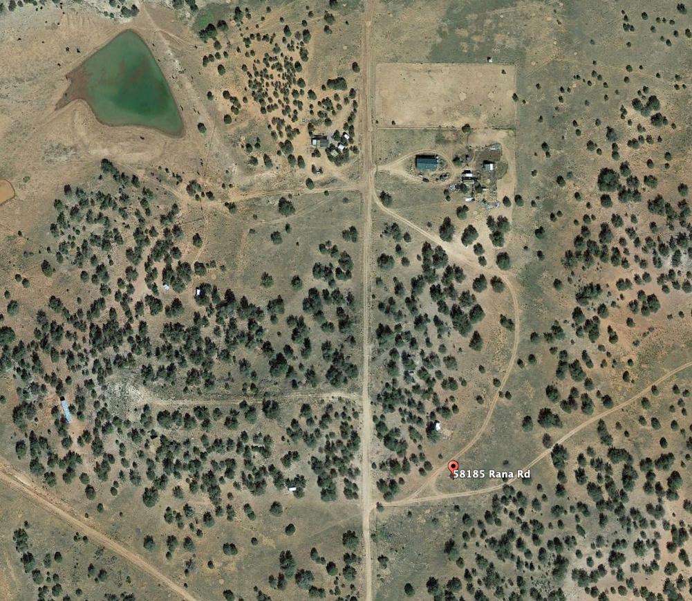
Turn right onto Rana Rd: 0.2 mi
Continue onto Yarmo Rd
Destination will be on the left
Approximate Distance to Nearby Cities & Points of Interest:
40 minutes to Seligman, AZ
59 minutes to the Grand Canyon Caverns
1 hour to Ash Fork, AZ
1 hour 25 minutes to Kingman, AZ
2 hours to Prescott (via I-40 E)
1 hour 50 minutes to Flagstaff, AZ
2 hours to Diamond Creek Beach on the Colorado River
2 hours 30 minutes to Sedona (via I-40 E)
Nearby States:
3 hours to Las Vegas, NV
4 hours to Joshua Tree National Park, CA
—
Subdivision: Bridge Canyon Country Estates
HOA/POA : No
Improvements: None
Water: by well or holding tank
Sewer: Would be by Septic
POLYGON DATA (GPS Coordinates):
35.3953501461071,-113.084930188884 ;35.3953700705298,-113.084940437325 ;35.3949548589113,-113.086188275276 ;35.394679530984,-113.086188639738 ;35.3942252597166,-113.086189244799 ;35.3951970694843,-113.084811820381 ;35.3952211839938,-113.084835988096 ;35.3952383799475,-113.084851743998 ;35.3952560162123,-113.084866800655 ;35.3952740820836,-113.084881053337 ;35.3952925410762,-113.084894546649 ;35.3953113936163,-113.084907236567 ;35.3953306027537,-113.084919122557 ;35.3953501461071,-113.084930188884
Utilities:
Alternative Energy (Solar, wind, or generator).
Phone would be cellular or Satellite.
TV/Internet would be Satellite
- ID: 3687
- Views: 287


